Tokyo, August 27 — A powerful typhoon named 'Sansan' is expected to hit the Amami region of southwestern Japan this week, bringing gusty winds and heavy rain. The Japan Meteorological Agency has issued warnings for the Amami Islands and the Pacific regions of western and eastern Japan.
According to Japan's state media, NHK, Typhoon Sansan was moving west-northwest over the southern sea of Japan at a speed of 20 kilometers per hour as of Monday at 3 p.m. The typhoon is predicted to strengthen further as it continues its westward path before turning northward and approaching the Amami Islands in Kagoshima Prefecture from Tuesday to Wednesday.
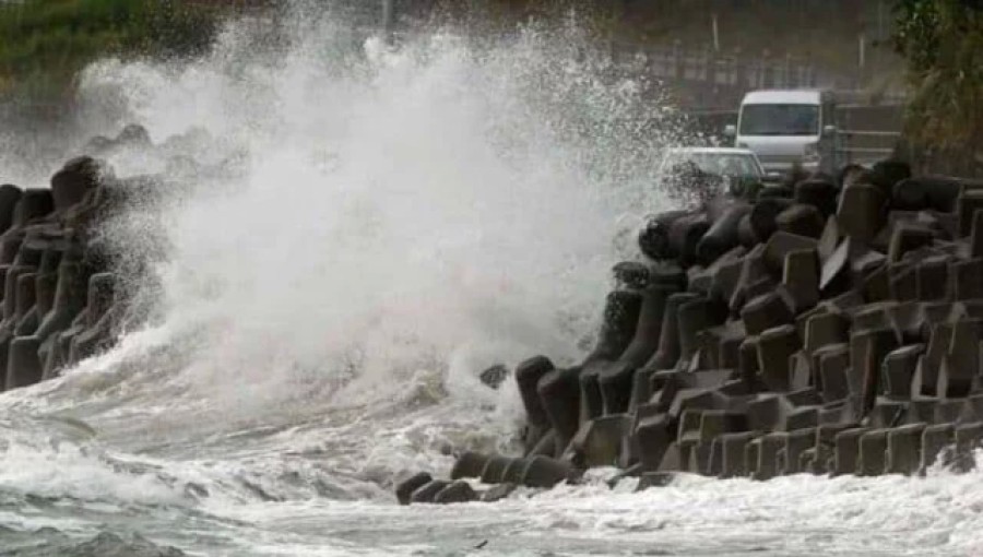
Local officials have forecast that the maximum wind speed in Amami could reach 108 kilometers per hour on Tuesday, while southern Kyushu could see wind speeds of up to 72 kilometers per hour. The wind speeds are expected to increase further on Wednesday.
In addition, the Tokai region is forecasted to receive up to 180 millimeters of rain over the next 24 hours starting Tuesday evening, while the southern Kyushu and Kansai regions may see up to 120 millimeters. The seas around Amami and western Japan are also expected to become very rough, with significant swells anticipated from Tuesday through Wednesday.
The Japan Meteorological Agency has issued warnings about potential hazards associated with the typhoon, including strong winds, high waves, landslides, flooding in low-lying areas, and rivers that could swell or overflow.
This forecast comes amid growing concerns about the increasing intensity and frequency of storms in the region. A recent study published last month indicated that climate change is contributing to the formation of storms closer to coastlines and their rapid intensification before landfall. Residents in the affected regions are advised to remain vigilant and prepare for possible evacuations as the typhoon approaches.