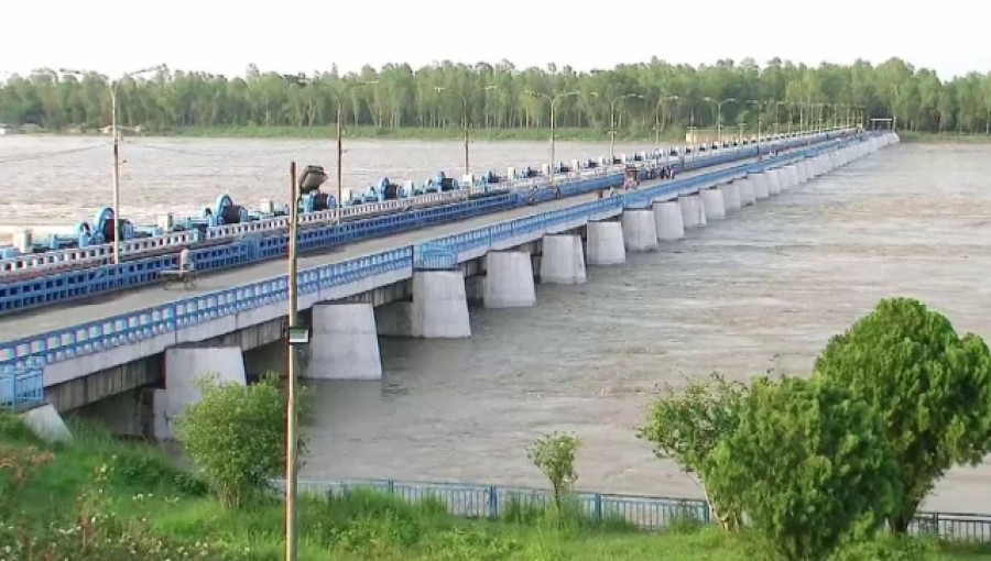
Lalmonirhat, Sep 28 (V7N) – The water level of the Teesta River continues to rise, nearing the danger level at the Teesta Barrage point due to heavy rains and increased upstream flow. At 9:00 a.m. on Saturday, the water flow at Dalia Point, part of the country's largest irrigation project, was recorded at 52 cm—just 0.15 cm below the danger level (normal is 52.15 cm). On Friday, the water was recorded 0.32 cm below the danger mark.
Authorities have responded by opening 44 gates of the Teesta Barrage to relieve pressure from the rising water levels. Asfa Ud Daula, Executive Engineer of the Dalia branch of the Water Development Board, confirmed that the rise in the Teesta's water level is due to the upstream flow and continuous rainfall. "If the water continues to rise, there could be a risk of flooding. However, if the rainfall decreases, the water levels will recede," he said, assuring that there is no immediate cause for concern for local residents.
The Water Development Board provided additional river data from the region: the Brahmaputra River at Chilmari point in Kurigram is at 20.04 cm (normal 23.25 cm), the Dudhkumar River at Pateshwari point is at 26.64 cm (normal 29.60 cm), and the Dharla River in Kurigram is at 22.90 cm (normal 26.05 cm). Meanwhile, in Gaibandha, the Yamuna River at Phulchari point is at 15.26 cm (normal 19.35 cm), and the Ghaght River at Gaibandha point is at 17.35 cm (normal 21.25 cm).
In June, five thousand people in the district were affected by sudden floods caused by a rapid rise in the Teesta’s water level, underscoring the ongoing risk of flooding during periods of intense rainfall.
Local authorities and rescue teams remain on alert as the situation develops.
END/RH/AJ



















Comment: